Off-road Trails
There are many miles of back country trails you can take from our Park. A few are shown below. Please visit us in the office for a map and more information. You can rent UTVs from several local vendors here. Please understand that the decision to take a specific trail is yours only to make based on weather, condition of the road, your experience, the condition of your vehicle and the range of your vehicle.
Here's some of the trails we have mapped for you: Sawtelle Peak, Big Springs, Fish Creek, Bear Gulch, Two Top, Continental Divide, Elk Lake Resort


Yellowstone RV Park at Mack's Inn recommends this breath-taking trip up Sawtelle Peak. At 10,000 feet you'll see forever, into Yellowstone, the Tetons, Red Rock Lakes Wildlife Refuge, Madison Range and best of all an expansive view of Henry's Lake. A 26 mile RT, it is a trip good for street legal UTV'er, 4WD, or regular car. Carry a heavy wrap, as it is very windy and cold on top. Look for wildflowers along the way.
Directions
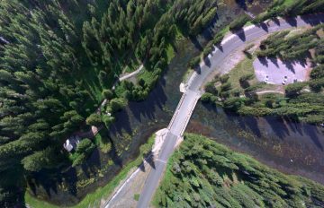
Leave our park on the north old 191 road, carefully cross South Big Springs Rd, and cross the bridge using the narrow ATV/Pedestrian path (give way to Pedestrians). Follow the dirt path on the east side of US20 to North Big Springs Rd. Drive slow to avoid dust on the highway and to watch out for ATVers coming the opposite way. VERY carefully cross US20 and take the south fork of the road Sawtelle Road all the way to the top (about 13 miles). Watch for vehicles coming down the road.
In late June and early July, watch for fields of wildflowers along the way.
Big Springs trail


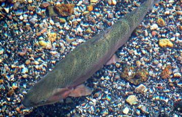
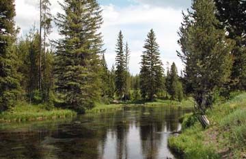
Yellowstone RV Park recommends this medium length drive (28 mi RT) to Big Springs, where the Henry's Fork of the Snake River begins bubbling out of the ground from a large aquifer on Yellowstone Plateau above. A beautiful place to visit, with large fish under the bridge to view (no fishing!). Walk around the springs and visit Johnny Sack cabin and water wheel. Good trip for any vehicle.
Directions to Big Springs
- Head south on Old Hwy 191 toward Strong Ave 0.3 mi
- Turn left at the 1st cross street onto Strong Ave 0.3 mi
- Turn right onto Murphy Loop 0.4 mi
- Turn right onto Pinewood Ln 0.5 mi
- Turn left onto Forest Rd 631B 0.3 mi
- Turn right at the 1st cross street onto S Big Springs Loop Rd 3.5 mi
- Turn right onto Forest Rd 059A and follow to Big Springs Parking Area
Bear Gulch trail


Yellowstone RV Park recommends this long and interesting ATV trail. You travel to Bear Gulch parking lot just north of Ashton, ID via the old Railroad Tracks (which were removed). UTV only trail, 45 miles round-trip.
Directions to Bear Gulch
Two Top Trail


Yellowstone RV Park suggests this trail that goes east and ends on the Yellowstone Plateau just on the Wyoming/Idaho border. It goes up a canyon before climbing to the bowl behind Two Top Mountain (about 7800 feet). The creek there is Tygee Creek and you'll see Beaver ponds along the creek. The trip is 20 miles one-way. You'll have to double back. Watch for bears at the top.
Directions to Two Top
- Head north on Forest Rd 134B 410 ft
- Turn left toward Hwy 20 E 154 ft
- Turn right onto Hwy 20 E 0.4 mi
- Turn right onto Teton Ave 0.7 mi
- Continue onto N Fork Club Rd 0.3 mi
- Turn left toward Forest 631C 407 ft
- Turn right onto Forest 631C 0.4 mi
- Continue onto Forest Rd 442 1.1 mi
- Turn right onto N Big Springs Loop Rd/NF-059 0.8 mi
- Turn left onto Meadow Creek Rd 2.0 mi
- Head north on Meadow Creek Rd 4.6 mi
- Turn left to stay on Meadow Creek Rd 1.4 mi
- Turn right onto Twin Creek Rd 420 ft
- Turn left onto Forest Rd 061/National Forest Develop Rd 061 Trail
- Continue to follow Forest Rd 061 7.0 mi
- Turn right
Continental Divide Trail


Yellowstone RV Park suggests this beautiful trail along the Continental Divide along the Henry's Lake Mountains ridge. Go north out of the RV Park to Red Rock Pass and then north at the Continental Divide Trail. Follow the map. Wildflowers, vistas of Henry's Lake and more. Climb to the top and overlook Henry's Lake. One-way trip about 20-25 miles depending on how far you explore the divide trail.
Directions to Continental Divide Trail
- Head north on Forest Rd 134B 410 ft
- Turn left toward Hwy 20 E 154 ft
- Turn right onto Hwy 20 E 5.6 mi
- Turn left onto NF-053/Red Rock Pass Rd
- Continue to follow NF-053 2.6 mi
- Continue onto Red Rock Rd 4.5 mi
- Turn left onto Red Rock Pass Rd
- Red Rock Pass sign will be on the left 4.3 mi
- Onto Continental Divide trail: Head east on National Forest Develop Rd 053 Trail/Red Rock Pass Rd/S Valley Rd toward National Forest Develop Rd 056 Trail 0.1 mi
- Sharp left onto National Forest Develop Rd 056 Trail Entering Montana 2.2 mi
- Slight left to stay on National Forest Develop Rd 056 Trail
- Drive to top of overlook and continue to explore the trail.
Elk Lake Trail


Yellowstone RV Park recommends this relatively long trip (29 miles one-way) to Elk Lake in Montana. You'll go over the Red Rock Pass into Montana on a pretty good gravel road. You'll pass large conservation ranches with tall mountains on both sides. You won't see many people. You'll pass Hell-Roaring Creek, the source of the Missouri River, and you'll go by beautiful Red Rock Creek. Enter the Red Rock Lakes National Wildlife Refuge and turn to Elk Lake. This is a beautiful lake nestled between two mountains. Take a further trip another 3 miles to Hidden Lake. Go for Lunch (12 - 1PM only) at the remote Elk Lake Lodge.
Directions to Continental Divide Trail
- Head north on Forest Rd 134B 410 ft
- Turn left toward Hwy 20 E 154 ft
- Turn right onto Hwy 20 E 5.6 mi
- Turn left onto NF-053/Red Rock Pass Rd Continue to follow NF-053 2.6 mi
- Continue onto Red Rock Rd 4.5 mi
- Turn left onto Red Rock Pass Rd Entering Montana 5.6 mi
- Continue onto S Valley Rd 5.6 mi
- Turn right onto US Frst Service Rd 8384, Elk Lake Rd
- Continue on Elk Lake Rd to the Resort on your right. 5.2 mi
Fish Creek Road
Yellowstone RV Park suggests this long trek up to the Yellowstone Plateau and through the forests surrounding Island Park. It's 45 mile loop.
Directions to Fish Creek Trail
- Head south on Old Hwy 191 toward Strong Ave 2.7 mi
- Turn left onto Forest Rd 419 0.2 mi
- Slight left onto Forest Rd 119 0.2 mi
- Turn right onto Yellowstone Branch Line Trail 9.9 mi
- Turn left onto Eccles Rd 338 ft
- Turn right to stay on Eccles Rd 0.3 mi
- Turn left onto Baker Draw Rd 9.6 mi
- Head north on Fish Creek Rd toward NF-108 9.5 mi
- Head north on Fish Creek Rd toward Black Canyon Loop Rd 8.8 mi
- Turn right onto S Big Springs Loop Rd
- Head southwest on S Big Springs Loop Rd toward Fish Creek Rd
